The Project
The project explores the industrial history of the river Devon corridor in Clackmannanshire. Although the river and its tributaries played an important role both in the industrial development of the county and in shaping the communities along its route, its industrial, environmental and cultural history is often overlooked.
Key objectives:
- To promote understanding of, and also to celebrate, the river’s rich and important industrial heritage
- To provide a lasting and tangible link between the individual schools through the physical landscape of the Devon corridor
- To complement the Ochils Landscape Partnership programme project, By the Banks of the Devon, which emphases the quality of habitat and recreational appeal of the river and its tributaries, and in particular the creation of a way-marked footpath through the valley.
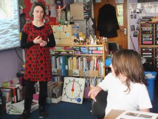
Through a series of interlinked classroom and field based sessions facilitated by CEHP staff and University student volunteers, pupils from six Hillfoots primary schools, including Alva, Menstrie, Tillicoultry, Coalsnaughton, Strathdevon and Muckhart pieced together the industrial history and examined the associated environmental and industrial landscape legacies of a section of the river Devon closest to their school premises.
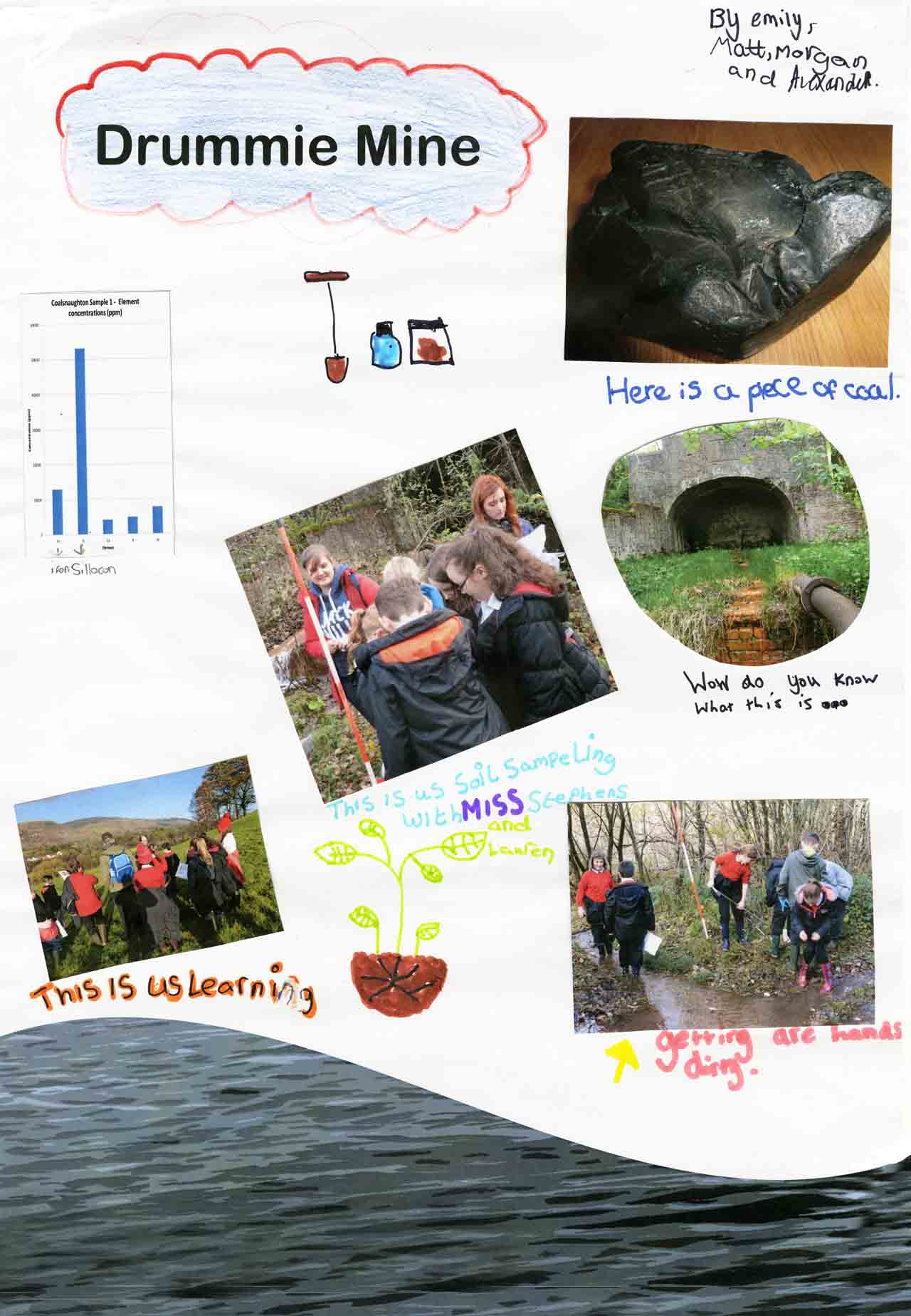
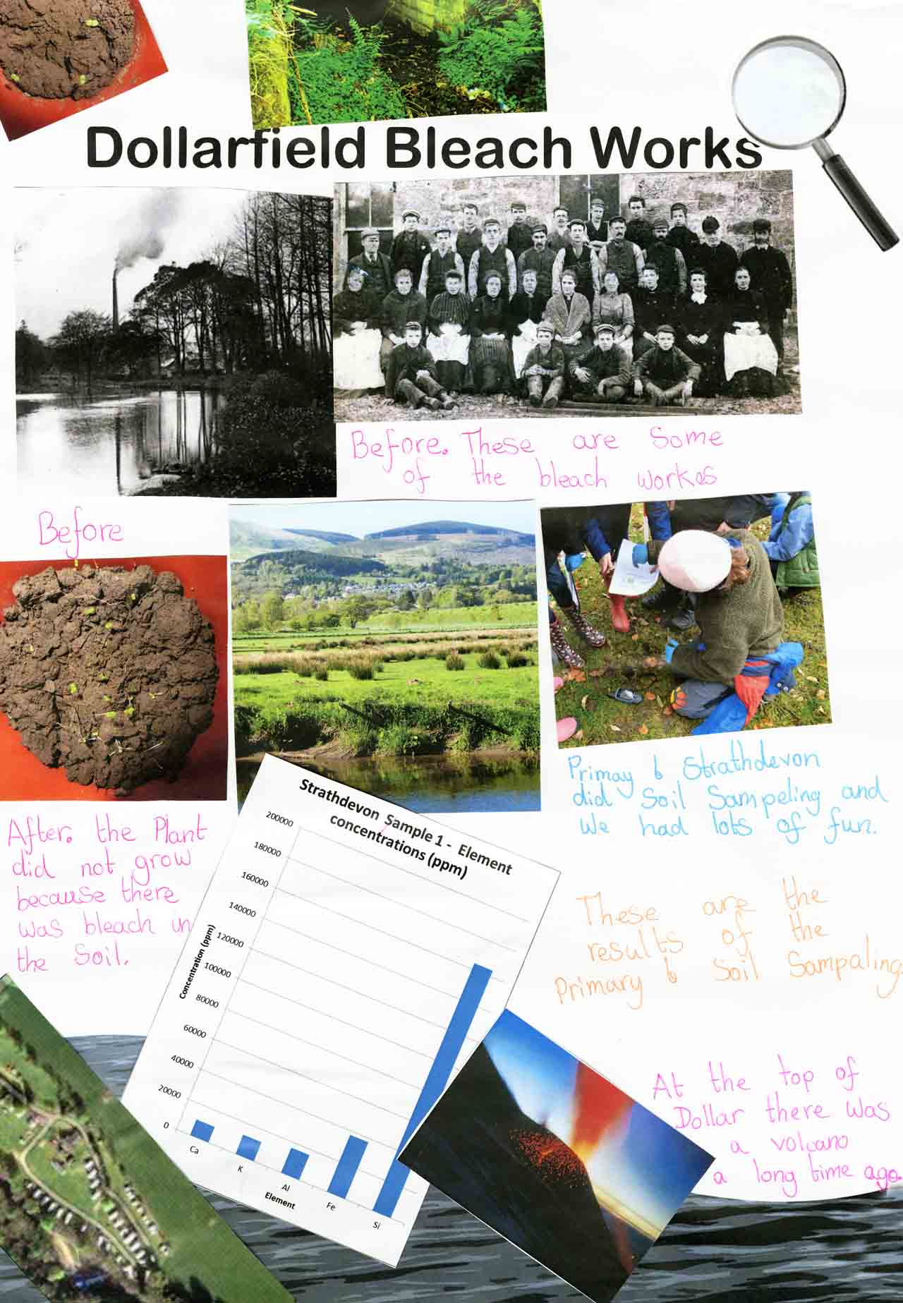
The pupils explored the history of their area’s industry by using primary source materials, such the Statistical Accounts, images, artefacts and mapping. By comparing historic with contemporary materials, this first session provided the pupils with a tangible connection to their local heritage and the role of history in shaping their current environment and community identity. Alva was no longer ‘just Alva’ but the place where Britain’s largest find of native silver was discovered and Coalsnaughton village really was built on coal both geologically and economically.
<table">
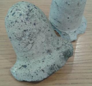
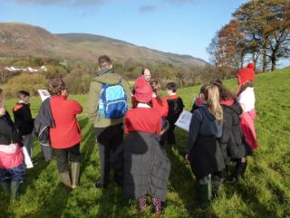
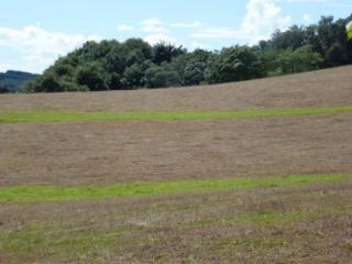
This was followed by an exploration of the physical landscape to identify any remaining industrial archaeology or ‘visible’ clues to the past and sampling of soil and water to assess the environmental impacts, the ‘invisible clues, of their local industry. As part of understanding the industrial legacy, Mimulus seeds were also planted in the soil materials removed from the post industrial sites to facilitate discussion on both the nutrient quality of the soil and the impact of pollution on plant growth.
|
|
|
The findings from the field and lab analyses provide interesting indicative indicators of past industrial activity at all sites and served as an excellent point of departure for discussion in the field and in the classroom of industrial society and environment interfaces. This discussion included notions of pollution and environmental protection, uniqueness and identity, and landscape change. It also allowed the introduction to aspects of the geo-sciences, including geological and historical timescales, field recording and sampling, the periodic table and x-ray based analyses of industrial soils.
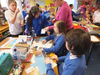
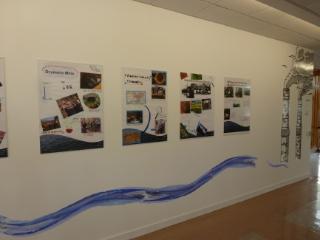
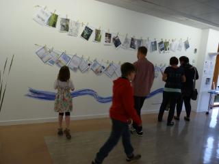
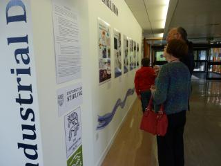
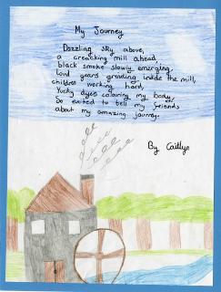
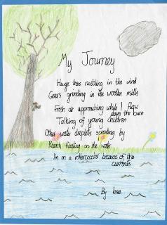
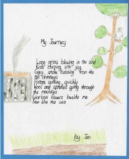
The class based and field sessions were brought together in the production of a team poster and ‘subsequent’ creative writing/drawing exercises that both charted the pupil’s discoveries as landscape detectives and explored perceptions of what life or work in the historic industry might have been like as well as their views of the post-industrial landscape. The pupil’s creative and written work was exhibited as part of the Ochils Festival and curated by the University Art Collection from June to September.
|
|
|
The Exhibition
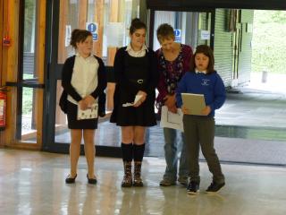
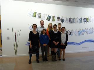
Exhibition and Launch
|

|
|
|
|
|
|
|
|
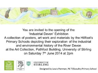
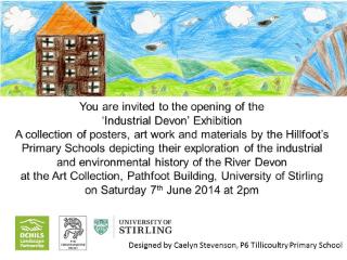
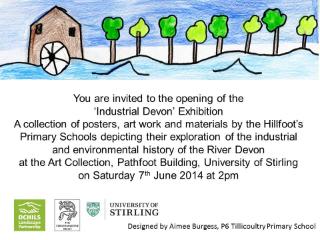
Examples of the Exhibition Launch Invites
|
|
|
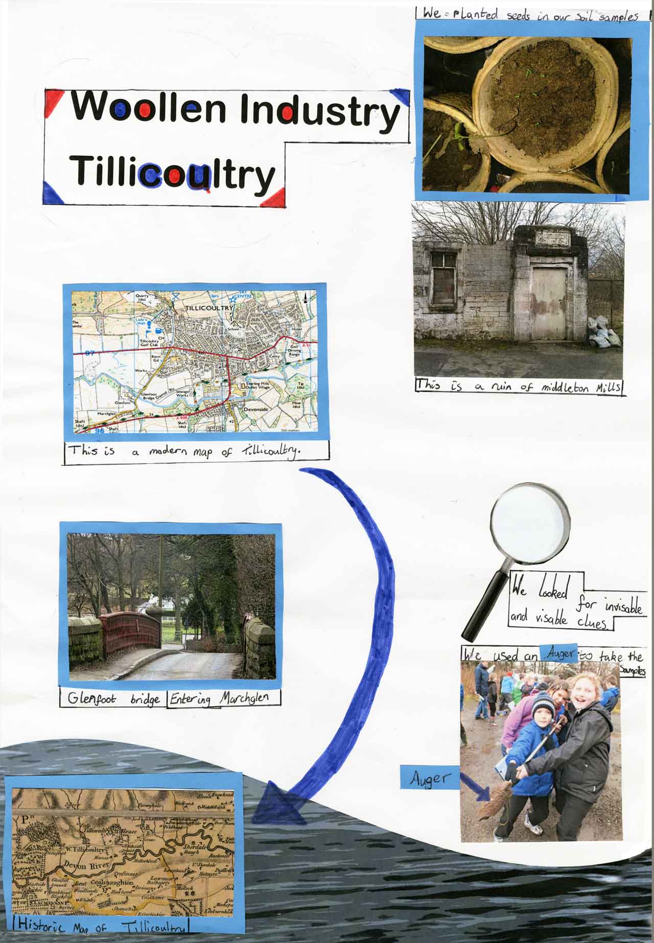
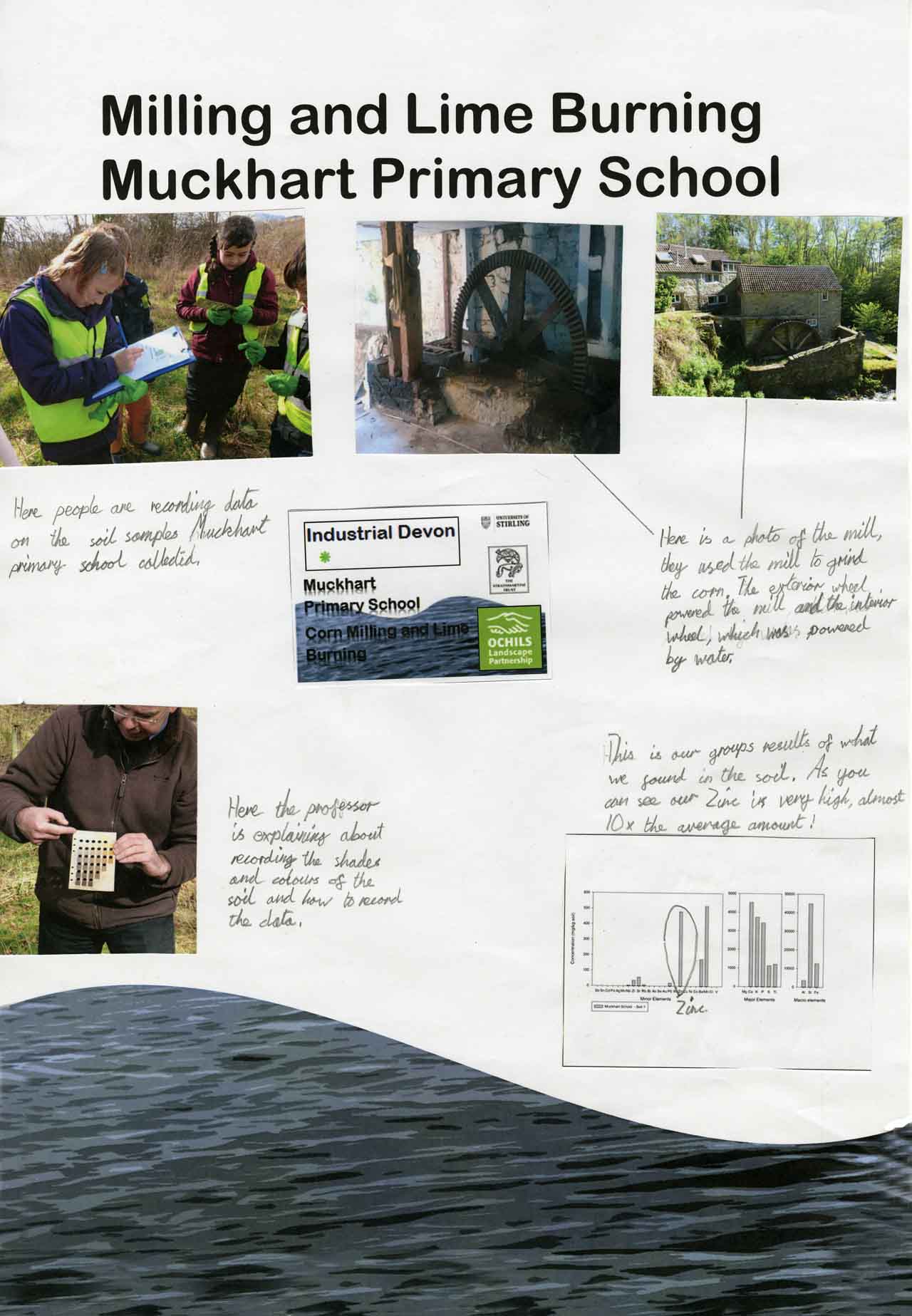
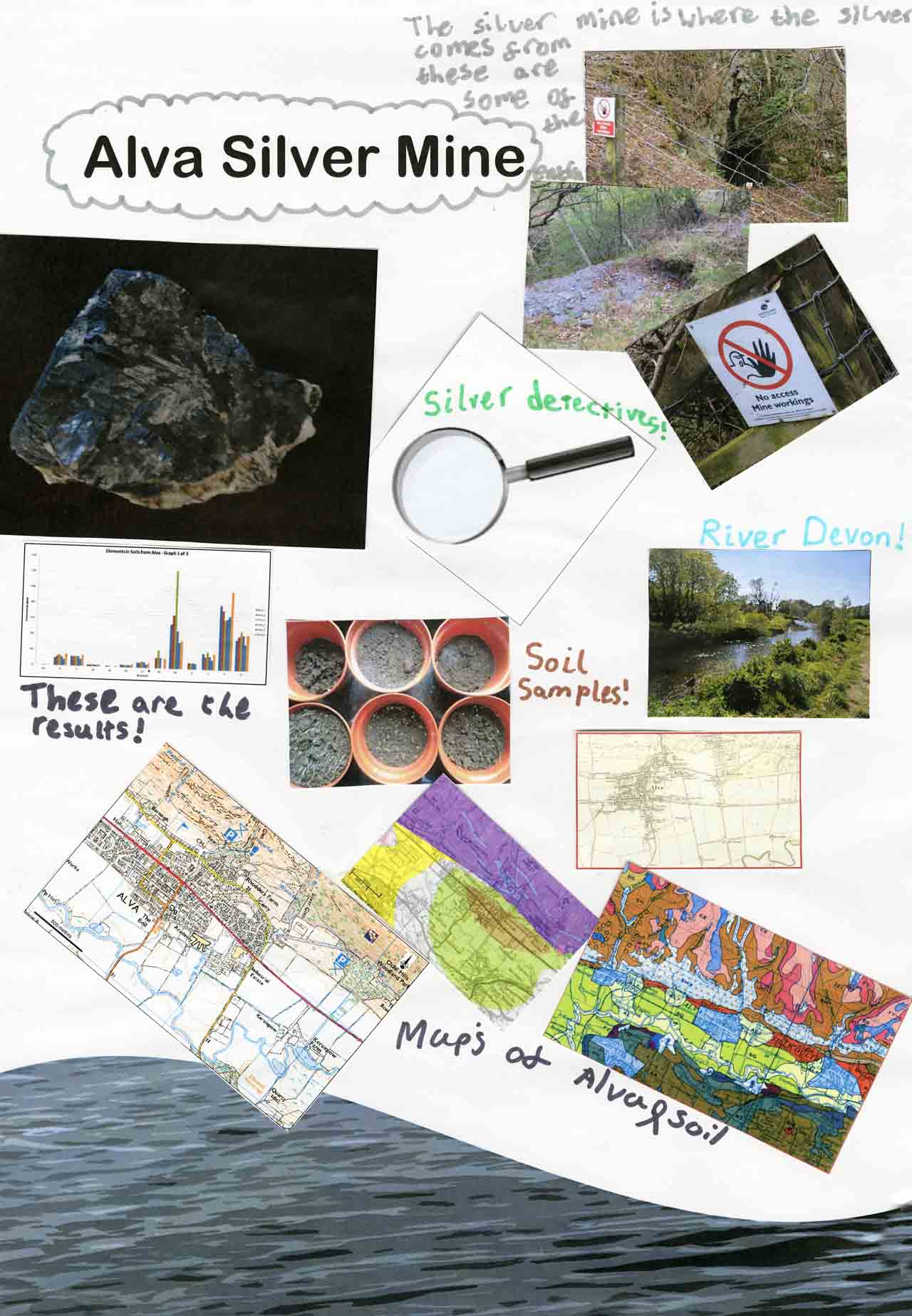
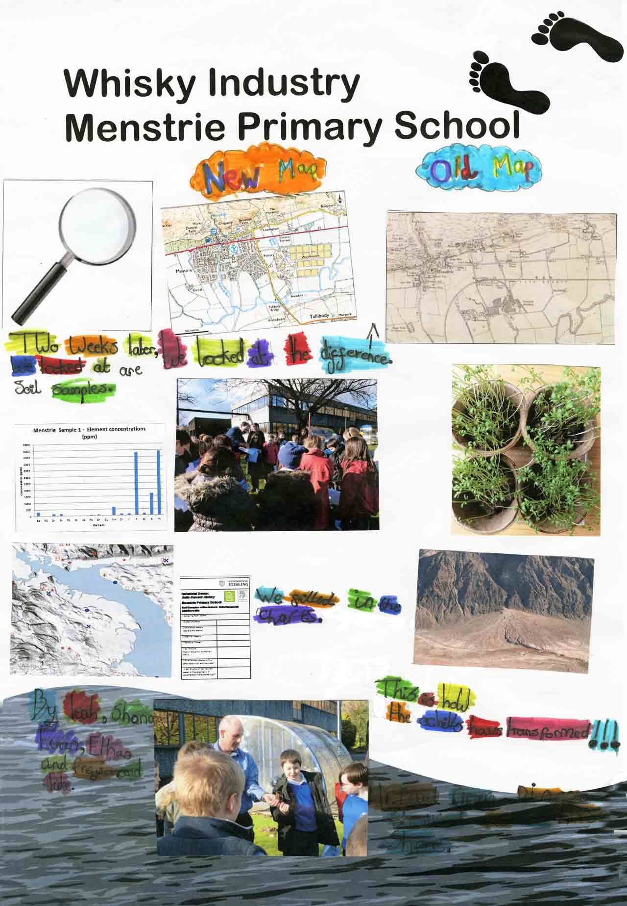
The Exhibition Posters
|
|
|
|
|
|
Teaching Materials
The Curriculum for Excellence serves as the basis for the project’s pedagogical design and follows the principles for curriculum design outlined therein. The project provides a coherent and relevant experience through the examination of the impact of local industry from many points of view: social, economic, and environmental. The project also provides pupils with a depth of knowledge of the history of a single industry while simultaneously allowing for breadth by including scientific analysis of the impact of this history on the local environment. The progression of the project builds on elements of their communities with which the students are already familiar and moves on to explore the origins and impacts of these elements using methods of research that allow for challenge and enjoyment. The multiple learning styles addressed by the project provide opportunities for personalisation and choice, ensuring that individual learning needs are met without sacrificing high aspirations for all pupils.
In meeting the key objectives laid out by the project, pupils develop the four capabilities stipulated in the Curriculum for Excellence: successful learners, confident individuals, responsible citizens and effective contributors. Pupils who participate in the project use literacy skills to gather evidence from primary sources, work in groups to take soil samples and to synthesize their learning in the final poster project, make reasoned evaluations concerning the environmental impact of their town’s industry, and link history and science to learn in a new way. The project gives pupils the opportunity to develop and communicate their own beliefs concerning the industrial heritage of the River Devon in the final creative writing project, and to evaluate the environmental issues that continue to impact the region. Finally, because of its explicitly community-based focus, the project naturally requires pupils to participate responsibly in their community, resulting in a deeper understanding of its historical and environmental legacy.
Below are some examples of the material used across the three sessions (Please feel free to adapt or copy if you wish to use them, alternatively we are happy to supply originals but please share you project ideas with the team. We would love to hear about how they are being used).
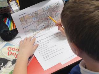
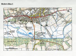
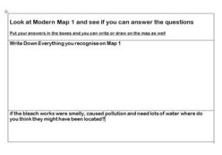
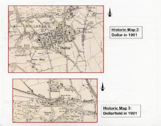
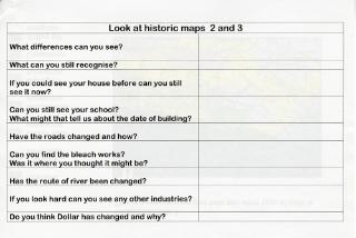
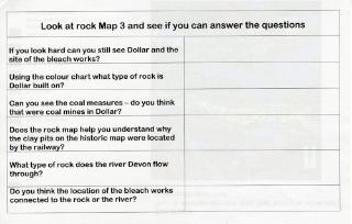
Maps and questionnaires
Using a series of modern and historic maps together with a series of questions the children working in small groups were able to explore the changes in the landscape across time.
|
|
|
|
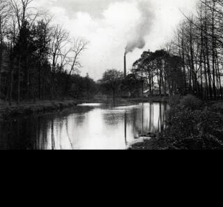
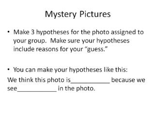
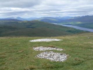
Mystery picture exercise
In order to give students the experience of ‘thinking like historians’, they were provided the mystery images depicted below and were encouraged to make a hypothesis about what they saw based on evidence from the image.
|
|
|
Teaching Materials - Field Work
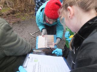
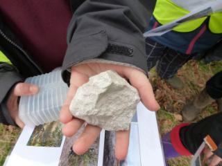
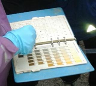
Field work
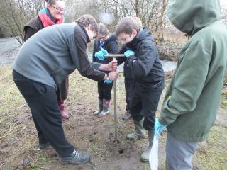
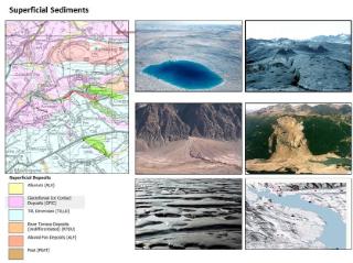
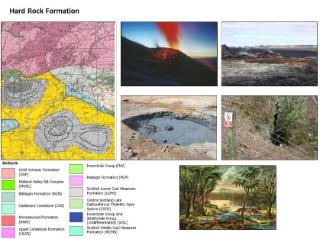
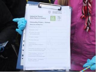
The children used geological and soil maps together with rock samples to understand how the ground beneath their feet was formed, what it is made of and how this related to both the historic location of their village and its associated industry. Working in their small groups the children sampled the soil using a hand held auger, described its colour, texture and structure at regular intervals along a single transect. They then recorded this information along with the depth of sample and its OS grid reference using a hand held GPS ready for analysis in the laboratory.
|
|
|
|
|
|
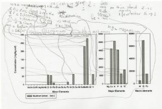
Understanding the Soil/Water Analysis
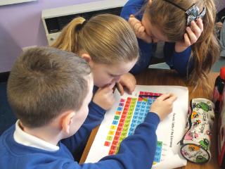
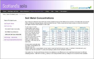
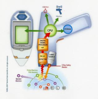
It was explained to the children how the samples were analysed (X-ray Fluorescence spectrometry or XRF for short using diagrammatic imagery such as depicted below). Then working in their small groups the children were provided with a graph of their results and using a periodic table they identified the elements present in their soil/water samples and then compared their results to background concentrations using data from Scotland’s Soils web site.
|
|
|
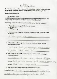
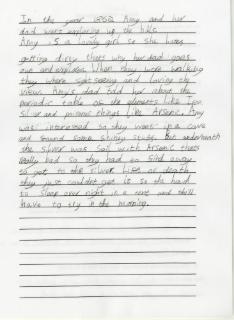
Creative writing
Along with their posters, students completed an individual creative writing assignment that was a synthesis of what they had learned during the previous two sessions. The template below was intended to guide their thinking prior to writing so they would have a mix of ‘fact’ and ‘fiction’ to incorporate into a story.
|
|
Project Team and Acknowledgements
Dr. Catherine Mills, University of Stirling, Division of History and Politics (Project lead)
Professor Ian Simpson, University of Stirling, Biological and Environmental Sciences (Field-work Lead)
Jennifer Geller, University of Stirling, Division of History and Politics (Project support)
Student volunteers
The team of undergraduate and postgraduate volunteers were drawn from across the academic disciplines primarily history, and both environmental geography and science.
Euan Burt (Environmental Science); Alison Chidwick (Environmental Geography); Lauren Dixon (Environmental Science and Politics); Katy Jack (History PhD); Christopher McKay, (MSc in Environment, Heritage and Policy); Eilidh MacRaild (Environmental Geography); James McKean (MSc in Environment, Heritage and Policy) and Heather Wilkinson (History)
Volunteering on the project offered Stirling University students the opportunity to enhance their employability and transferable skills.
- Through liaison with outside agencies including local schools
- by promoting community engagement with the local environment and its industrial heritage
- ‘hands on’ exploration of ways in which a lasting and tangible link between community, heritage and education can be achieved and replicated
Participation in the project also offered, particularly the undergraduate students, early experience of ‘real world’ archival research and environmental investigation in preparation of their dissertation but importantly to play a unique role in its dissemination.
Acknowledgements
Special thanks go to:
- The landowners for allowing the children to sample the soil/water: R Marshall; Sterling Mills; Dollarfield Caravan Park; E Geddes (Straith Estates); Julian Bell; Diageo (Mr. Ally Paul)
- Bill Jamieson (mapping); Ronnie Balfour (Equipment); Dr. Claire Wilson (Tillicoultry field work); Dr. Paul Adderley (analysis and charts); Dr. Shane MacLeod (field work support); Helen Ewen (water analysis); Janet Carolan at Dollar Museum; Alloa Archives and Library; Dr. Kirsty McAllister (OLP) and Amanda Joaquin (Clackmannanshire Council Volunteer officer)
The Strathmartine Trust for generously funding the project
|
|