I am a lecturer and researcher in Remote Sensing and Natural Hazards, and currently serve as Programme Director for Environmental Sciences. My research involves the application of data from NASA and ESA satellites, in addition to those operated by JAXA, to investigate emissions and patterns of activity in natural hazards. I am particularly focused on the assessment of volcanic eruptions using multi-sensor satellite data.
Brief Biography - Current Position
-
Programme Director for Environmental Sciences (2024-present, University of Stirling, BES)
-
Lecturer in Remote Sensing (2022-ongoing: University of Stirling, BES)
-
Deputy Chair of the BES Equality, Diversity and Inclusion (EDI) Committee (2023-present)
-
Creator and Lead of the BES Visibility of Inclusion for Boosting Equity (VIBE) Initiative designed to improve the integration of historically excluded individuals from Higher Education (2023-present)
for more details please see (https://www.stir.ac.uk/about/faculties/natural-sciences/biological-environmental-sciences/equality-and-diversity/)
Brief Biography - Historic Positions
-
Research Scientist in Volcano Remote Sensing (2019-2021: NASA Goddard Space Flight Center – Administered by USRA) on a project entitled Volcanology from Space.
-
NASA Postdoctoral Program Research Fellow in the Development of Multi-sensor Techniques for Analysing Volcanoes from Space (2016-2019: NASA Goddard Space Flight Center – Administered by USRA)
-
PhD in Geology specifically Volcano Remote Sensing (2012-2015: Michigan Technological University, USA)
-
MSc Applied Meteorology and Climatology (2009-2010: University of Birmingham)
-
Geotechnical Engineer – Landfill construction and capping (2008-2009: White Young Green – Agency Staff)
-
BSc (Hons) Environmental Hazards (2005-2008: University of Portsmouth)
Additional Responsibilities:
-
NASA Goddard MISR research team (2016-present)
-
NASA HQ Disaster Response Team member (2018-2021)
-
Member of the NASA Goddard Space Flight Center - Disaster Working Group (2016-2021)
I use satellite-based remote sensing data to develop novel ways to investigate volcanic eruptions and assess there environmental impact. By understanding remote sensing signals generated by volcanoes , we can better understand the dynamics of how volcanoes erupt and ultimately improve our response to emergent eruptions.
Current Research: Investigating the impacts of diffuse volcanic plumes on long term remote lake observations (2024-present)
This research, funded by the European Space Agency (ESA), aims to assess if the presence of diffuse plumes of volcanic particles and aerosols, held in atmospheric suspension, impact long term lake monitoring data, measured by satellite-based sensors. This project aims to improve the consistency and usability of ESA's global Lakes CCI dataset.
ESA's Lakes CCI project: Develops satellite-derived products for the Lakes Essential Climate Variable (ECV), including Lake Water Level, Lake Water Extent, Lake Surface Water temperature, Lake Ice Cover, Lake Ice Thickness, and Lake Water-Leaving Reflectance, to monitor and understand the impacts of climate change on lakes globally.
Postdoctoral Research: For the five years following my PhD (2016-2021) I was a researcher at NASA’s Goddard Space Flight Center. During this time, I developed a space-based technique for analysing volcanic eruptions using satellite sensors that have been in operation for up to 20 years. The Multiangle Imaging Spectroradiometer (MISR), which is capable of identifying the height of plumes in the atmosphere, was my primary research instrument. However, I combined these data with thermal anomaly measurements and sulphur dioxide observations. By combining data from complimentary satellites, which monitor different aspects of volcanic eruptions (e.g., volcanic plumes, gas clouds, lava flows), I am able to build up a picture of the eruption and how it develops over time.
I also apply similar techniques to other natural disasters, particularly wildfires, where the processes are similar (e.g., generation of ‘hot spots’ on the ground, production of plumes).
PhD Research: My doctoral research focused on the long-term analysis of sulphate emissions from volcanic systems using satellite data. I performed statistical analyses to establish whether cyclical processes were occurring in volcanic systems. The most notable cyclical activity was identified at Soufriere Hills volcano (Montserrat), with the satellite observations matching those previously identified in ground-based data. During this time, I also completed a number of works outside of the volcanic field predominantly relating to systematic errors in satellite data timeseries and background correction calculation for satellite data.
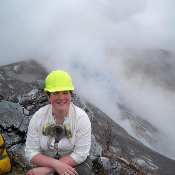
Field experience: During my academic career I have been fortunate enough to participate in a number of field campaigns. Most notably in Costa Rica and Dominica.
In Costa Rica I was involved in collecting ground-based volcanic emission measurements using remote sensing techniques. The highlight of this trip was sitting less than 100 meters from the erupting vent of an active volcano.
In Dominica, I completed a number of ground-based hazard and vulnerability assessment to produce risk maps for the second largest community, Portsmouth, on the Caribbean island. The hazard assessments completed included consideration of volcanic (ash fall, pyroclastic flow, lahars), coastal (tsunamis, storm surges) and hydrological (flooding) hazards. Complimentary vulnerability assessments were also conducted and included identification of the location of residential communities, key infrastructure and emergency services. The combination of these data facilitated the production of combined risk maps.
Additional experience: Outside of academia, I gained 2 years of experience as a Geotechnical Engineer (2008-2009). My responsibilities included the monitoring of construction workers in the placement and engineering of new landfills as well as the capping of existing pits. Additional responsibilities included compiling compliance reports and retrieving physical samples from engineered surfaces to be tested at specialist labs.